-
 ×
- Hjem
- Kunsttrykk ▸
- Kunstnere ▸
- Kategorier ▸
- Kunststiler ▸
- Bilderamme ▸
- Trykkmateriale ▸
- Alle trykkmedier
- Lerret Leonardo (sateng)
- Lerret Salvador (matt)
- Lerret Raphael (matt)
- FineArt Photo Matte
- FineArt Photo Satin
- FineArt Photo Baryte
- FineArt Photo Glossy
- Akvarell papp Munch
- Akvarell papp Renoir
- Akvarell papp Turner
- Akvarell papp Dürer
- Natural Line Hemp
- Natural Line Rice
- Kozo White, 110g
- Kozo Natural, 110g
- Inbe White, 125g
- Unryu, 55g
- Bamboo, 110g
- Premio Unryu, 165g
- Murakumo Natural, 42g
- Bizan Natural, 300g
- Bizan White, 300g
- Kompositt av aluminium 3mm
- Akrylglass 5mm
- Bestill prøvesett
- Hvilket trykkmedium passer?
Lerret
Fotopapir
Akvarellkartong
Natural Line
Japansk papir
Spesialmedier
Mer informasjon
- Hjelp og service ▸
- Kontakt oss
- Selg kunsten din
- Ofte stilte spørsmål
- Ledige stillinger
- Reklamasjon
- Bestill prøver
- Bestill gavekort
- Fraktkostnader
- Produksjonstid
- Bærekraft
- Bildeundersøkelse
- Spesielle forespørsler
- Hvem er vi?
- Prisstrategi
- Bedriftspolitikk
- Kvalitetsløfte
- Utmerkelser
- Blindramme
- Passepartout
- Dekorative rammer
- Glas
- Lister
- Opphengssystemer
- Trykkmedier
- Vedlikeholdstips
- Avtrykk
- Betingelser og vilkår
- Databeskyttelse
- Angrerett
Info og service
Mer informasjon
Verdt å vite
Rettsinformasjon
- Nettbutikk ▸
- Kontakt


 Se i 3D / AR
 Legg til favoritter
 Velg veggfarge
 Vis maleriet i et rom
.jpg "Alfabetisk tabell med navn på byer, landsbyer etc. som er på kartet over nederlandske Gelderland, etc., av sr. Sanson")


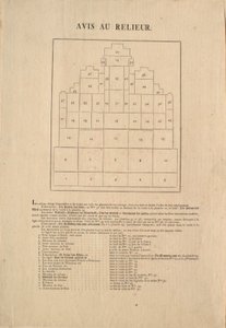


.jpg "Grunnplan for de tretten markedene i byen New York, 1833 (svart blekk, med fargevask, på papir)")


.jpg "Høyden til de hittil målte fjellene")


.jpg "Geologi, 1833-39")
.jpg "Nedstigning av de europeiske herskerne fra keiser Ferdinand I og kong Rudolf I av Habsburg")


.jpg "Plan for Royal Mint in the Tower, 1701")


.jpg "Storfekjøtt: diagram som viser de forskjellige stykningsdelene")

.jpg "Akilles")


.jpg "«Mannen med seks hoder», karikatur av Charles Maurice de Talleyrand-Périgord (1754-1838), 1815")


.jpg "Kart over Antwerpen, 1598")

 - (MeisterDrucke-85508).jpg "Kart over Phillipsburg, fra «Guerre de l")
 - (MeisterDrucke-137051).jpg "Kart over Rhode Island, fra «Guerre de l")
.jpg "Kart over slaget ved Camperdown, utgitt av William Blackwood and Sons, Edinburgh og London, 1848")
.jpg "Loggans kart over Oxford, vestlig blad, fra «Oxonia Illustrated», utgitt 1675")

.jpg "Kart over Arabia på 1500-tallet, fra «Sala delle Carte Geografiche» (Salen med geografiske kart), 1575")
 (see also 330950) - (MeisterDrucke-87632).jpg "Kontinentet Europa, fra et verdensatlas med 33 kart, Venezia, 1. september 1553")
.jpg "Globen")
 (see also 330947) - (MeisterDrucke-79815).jpg "Kontinentet Afrika, fra et verdensatlas med 33 kart, Venezia, 1. september 1553")
.jpg "Kart over Amerika, 1878")

.jpg "Septentrionalium terrarum descriptio, kart over Arktis, 1595")
.jpg "Kart over Tyskland, Germania Antiqua, fra «The Atlas of Ancient Geography» av Samuel Butler, utgitt i London, ca. 1829")

.jpg "Rosene, 1925-26")

.jpg "Madonna med barnet og to engler")


.jpg "Reven, 1913")


.jpg "Vannliljedammen om kvelden")
.jpg "Den røde vingården ved Arles")
.jpg "Etter badet, 1890")
.jpg "Marie Krøyer sittende i liggestolen i hagen ved fru Bendsens hus")
.jpg "Potetspiserne, 1885")


 +43 4257 29415
 support@meisterdrucke.com
 Mo-Do: 7:00 - 16:00 | Fr: 7:00 - 13:00